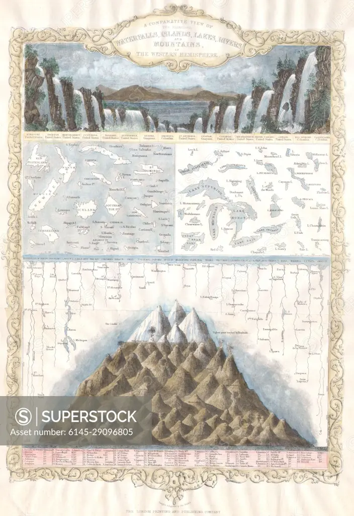
1850 Tallis Maps of the Mountains, Rivers, Waterfalls Islands of the Western Hemisphere (America)
SuperStock offers millions of photos, videos, and stock assets to creatives around the world. This image of Explore the Fascinating 1842 Map of Geological Heights and Sea Depths: Ancient Lands and Waters Chart by Piemags/PL Photography Limited is available for licensing today.
Looking for a license?
Click here, and we'll help you find it! Questions? Just ask!
Click here, and we'll help you find it! Questions? Just ask!
DETAILS
Image Number: 6145-29096805Royalty FreeCredit Line:Piemags/PL Photography Limited/SuperStockCollection: