1866 Mitchell Map of Washington D.C.

1866 Mitchell Map of Washington D.C.
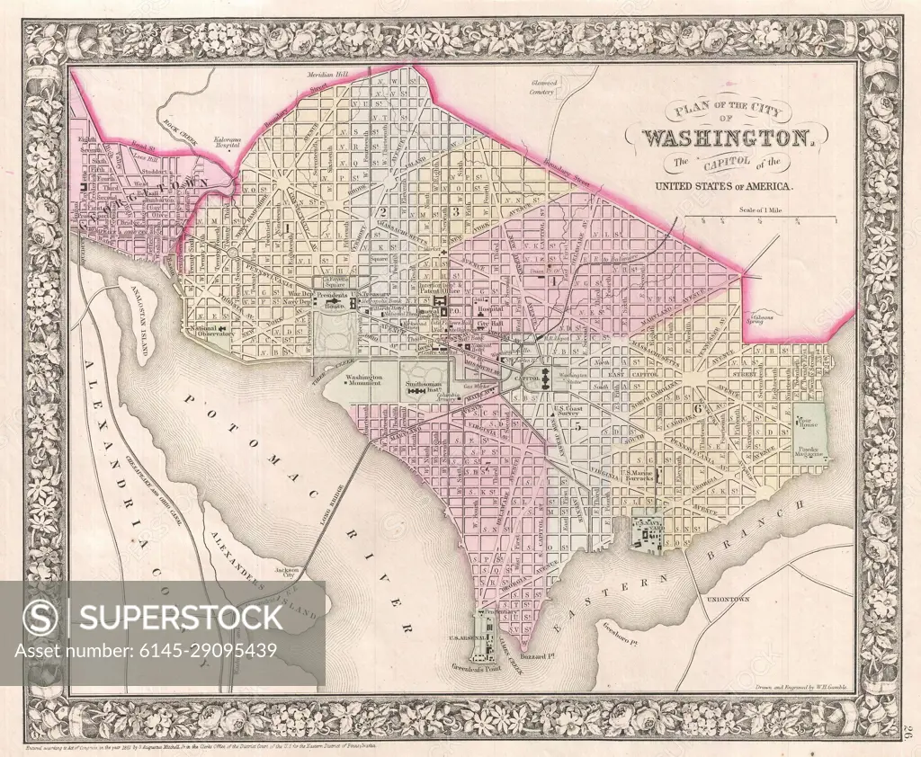
SuperStock offers millions of photos, videos, and stock assets to creatives around the world. This image of Explore Historic Washington D.C.: Vintage Map Reveals City's 19th Century Layout by Piemags/PL Photography Limited is available for licensing today.
Royalty Free License
Royalty-Free Standard Commercial licenses are granted for worldwide, non-exclusive and perpetual use, unless specifically noted otherwise. All Royalty-Free transactions are final. The Royalty-Free Standard Commercial license has no limitations and covers up to 15 users.
  • $50.00 Low500 X 411
  • $150.00 Med750 X 617
  • $250.00 High3500 X 2880
  • Download your images from the download tab on this page after purchase.
  • Up to 5 downloads
  • Can be used for a year after purchase.
$1,225.00
RF High / Super Res 5 Pack
Save $25.00
$245.00
per download
Order a Framed Print
DETAILS
Image Number:  6145-29095439Royalty FreeCredit Line:Piemags/PL Photography Limited/SuperStockCollection:Contributor:Model Release:NoProperty Release:NoResolution:3500×2880
|
|
|