1853 U.S.C.S. Map of Cape Fear, North Carolina

1853 U.S.C.S. Map of Cape Fear, North Carolina
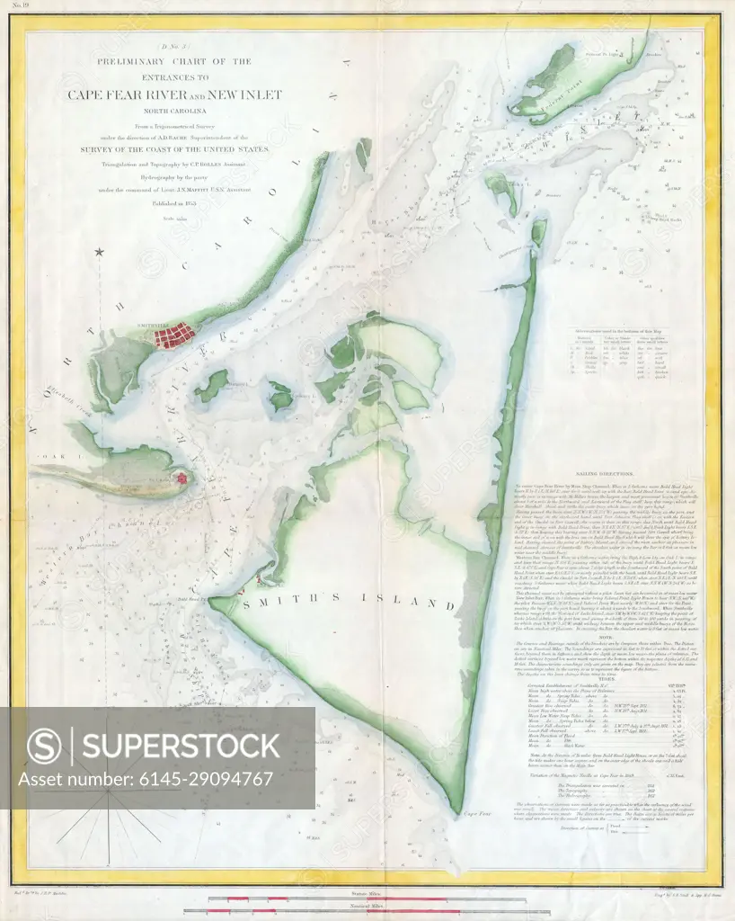
SuperStock offers millions of photos, videos, and stock assets to creatives around the world. This image of Explore Historic Nautical Charts: Detailed Map of Cape Fear River and New Inlet from 1855 by Piemags/PL Photography Limited is available for licensing today.
Royalty Free License
Royalty-Free Standard Commercial licenses are granted for worldwide, non-exclusive and perpetual use, unless specifically noted otherwise. All Royalty-Free transactions are final. The Royalty-Free Standard Commercial license has no limitations and covers up to 15 users.
  • $50.00 Low400 X 500
  • $150.00 Med600 X 750
  • $250.00 High4000 X 5002
  • Download your images from the download tab on this page after purchase.
  • Up to 5 downloads
  • Can be used for a year after purchase.
$1,225.00
RF High / Super Res 5 Pack
Save $25.00
$245.00
per download
Order a Framed Print
DETAILS
Image Number:  6145-29094767Royalty FreeCredit Line:Piemags/PL Photography Limited/SuperStockCollection:Contributor:Model Release:NoProperty Release:NoResolution:4000×5002
|
|
|
|
|
|