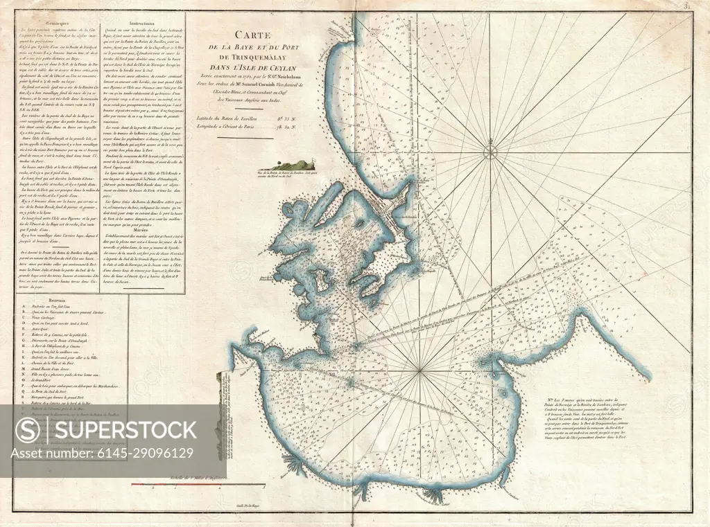
1775 Mannevillette Map of Trincomalee, Ceylon or Sri Lanka
SuperStock offers millions of photos, videos, and stock assets to creatives around the world. This image of Antique Nautical Map of the Port of Callao: Explore 19th-Century Maritime Navigation and Coastal Geography of Peru's Historic Harbor. by Piemags/PL Photography Limited is available for licensing today.
Looking for a license?
Click here, and we'll help you find it! Questions? Just ask!
Click here, and we'll help you find it! Questions? Just ask!
DETAILS
Image Number: 6145-29096129Royalty FreeCredit Line:Piemags/PL Photography Limited/SuperStockCollection: