1794 Laurie and Whittle Map of Holland or The Netherlands
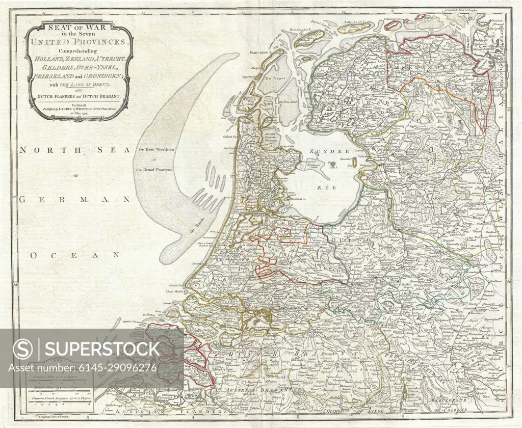
SuperStock offers millions of photos, videos, and stock assets to creatives around the world. This image of Explore the Historic Map of the United Provinces: A Detailed View of 18th-Century Netherlands and Surrounding Regions. by Piemags/PL Photography Limited is available for licensing today.
Looking for a license?
Click here, and we'll help you find it! Questions? Just ask!
Click here, and we'll help you find it! Questions? Just ask!
DETAILS
Image Number: 6145-29096276Royalty FreeCredit Line:Piemags/PL Photography Limited/SuperStockCollection: