1747 La Feuille Map of Brabant ( vicinity of Brussels ), Belgium

1747 La Feuille Map of Brabant ( vicinity of Brussels ), Belgium
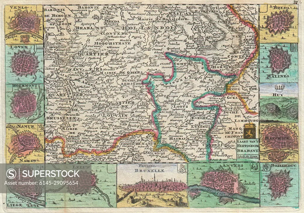
SuperStock offers millions of photos, videos, and stock assets to creatives around the world. This image of Explore Historical Cartography: Antique Map of Belgium and Surrounding Cities – Discover Detailed 18th Century Geography and Urban Landscapes. by Piemags/PL Photography Limited is available for licensing today.
Royalty Free License
Royalty-Free Standard Commercial licenses are granted for worldwide, non-exclusive and perpetual use, unless specifically noted otherwise. All Royalty-Free transactions are final. The Royalty-Free Standard Commercial license has no limitations and covers up to 15 users.
  • $50.00 Low500 X 351
  • $150.00 Med750 X 526
  • $250.00 High2500 X 1755
  • Download your images from the download tab on this page after purchase.
  • Up to 5 downloads
  • Can be used for a year after purchase.
$1,225.00
RF High / Super Res 5 Pack
Save $25.00
$245.00
per download
Order a Framed Print
DETAILS
Image Number:  6145-29095654Royalty FreeCredit Line:Piemags/PL Photography Limited/SuperStockCollection:Contributor:Model Release:NoProperty Release:NoResolution:2500×1755
|
|
|
|
|
|