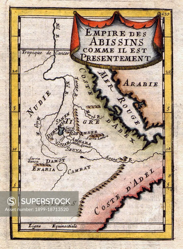
A French map of the Red Sea and East African Coast dated 1683 and showing parts of Arabia, Nubia, Sudan, South Sudan, Somalia and East Africa.
SuperStock offers millions of photos, videos, and stock assets to creatives around the world. This image of A French map of the Red Sea and East African Coast dated 1683 and showing parts of Arabia, Nubia, Sudan, South Sudan, Somalia and East Africa. by Pictures From History/Universal Images is available for licensing today.
Looking for a license?
Click here, and we'll help you find it! Questions? Just ask!
Click here, and we'll help you find it! Questions? Just ask!
DETAILS
Image Number: 1899-18713520Rights ManagedCredit Line:Pictures From History/Universal Images/SuperStockCollection: