1872 U.S. Coast Survey Map of Plattsburgh and Lake Champlain, New York
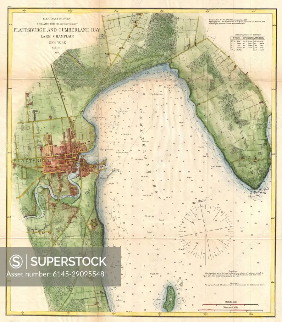
SuperStock offers millions of photos, videos, and stock assets to creatives around the world. This image of Explore the Historical Map of Plattsburgh and Cumberland Bay on Lake Champlain - Nautical Chart from 1906 by Piemags/PL Photography Limited is available for licensing today.
Looking for a license?
Click here, and we'll help you find it! Questions? Just ask!
Click here, and we'll help you find it! Questions? Just ask!
DETAILS
Image Number: 6145-29095548Royalty FreeCredit Line:Piemags/PL Photography Limited/SuperStockCollection: