The Carta Marina (Latin 'map of the sea'), created by Olaus Magnus in the 16th century, is the earliest map of the Nordic countries that gives details and placenames. The map was created in Rome by the Swedish ecclesiastic Olaus Magnus (1490Äì1557),
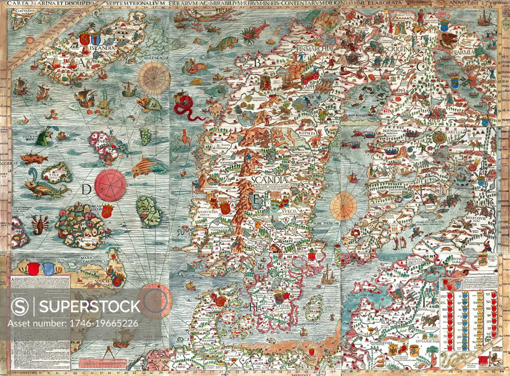
SuperStock offers millions of photos, videos, and stock assets to creatives around the world. This image of The Carta Marina (Latin 'map of the sea'), created by Olaus Magnus in the 16th century, is the earliest map of the Nordic countries that gives details and placenames. The map was created in Rome by the Swedish ecclesiastic Olaus Magnus (1490Äì1557), by Image Asset Management/World History Archive is available for licensing today.
Looking for a license?
Click here, and we'll help you find it! Questions? Just ask!
Click here, and we'll help you find it! Questions? Just ask!
DETAILS
Image Number: 1746-19665226Rights ManagedCredit Line:Image Asset Management/World History Archive/SuperStockCollection: