1758 Bellin Map of Saint Lucia (Sainte Lucie), West Indies
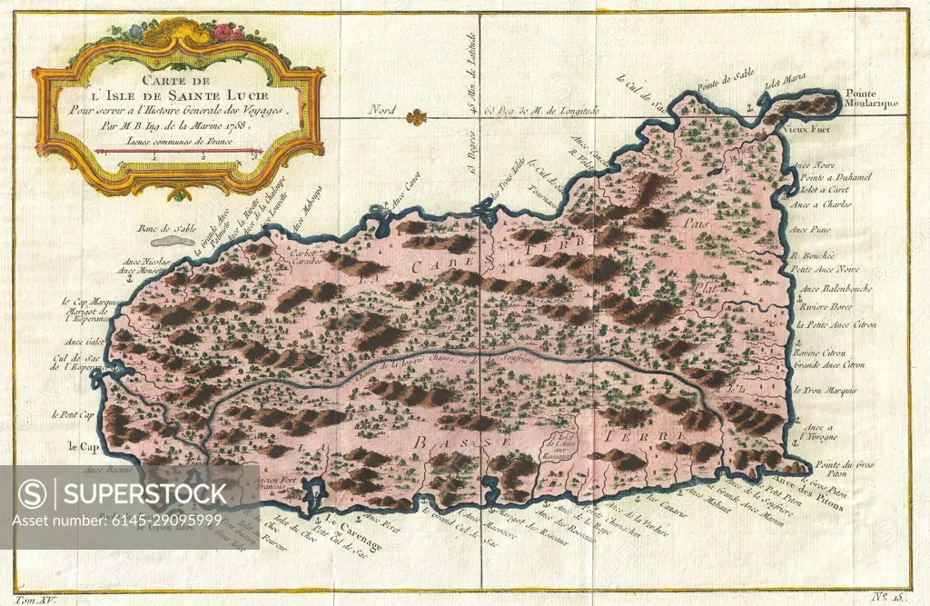
SuperStock offers millions of photos, videos, and stock assets to creatives around the world. This image of Explore Historical Cartography: Antique Map of Saint Lucia Island - A Glimpse into 18th Century Geography and Navigation. by Piemags/PL Photography Limited is available for licensing today.
Looking for a license?
Click here, and we'll help you find it! Questions? Just ask!
Click here, and we'll help you find it! Questions? Just ask!
DETAILS
Image Number: 6145-29095999Royalty FreeCredit Line:Piemags/PL Photography Limited/SuperStockCollection: